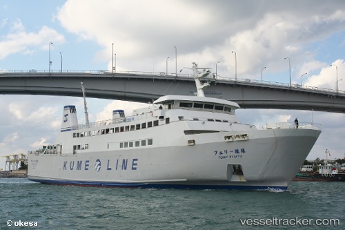
Ferry Ryukyu
Current StatusWhere is the vessel?
Ferry Ryukyu is currently in Near Kumejima, based on AIS data received about 18h ago.
Latest AIS update:
Current position: 26.34033° N, 126.75356° E (Near Kumejima)
Average speed (last 7 days): Loading…
Average speed (last 30 days): Loading…
Vessel profile: Ferry Ryukyu is a Passenger Ro Ro Cargo Ship with dimensions 14m x 84m.
This page combines live AIS, route history, probable destination signals, nearby traffic, and port activity for practical vessel monitoring.
The current position of vessel Ferry Ryukyu is 26.34033 lat / 126.75356 lng. Updated: 2026-05-20 04:03:28 UTCNearest reference points:
- 77 nm SE of Miyakojima
- 18 nm W of Koniya
Details:
Live Vessel Ferry Ryukyu Analytics (details, animations, etc.)
Recent AIS points (UTC):
2026-05-20 04:03:28 UTC · 26.34033, 126.75356 · SOG 0 kn · COG 232°2026-05-20 04:03:28 UTC · 26.34033, 126.75356 · SOG 0 kn · COG 232°
2026-05-20 04:03:28 UTC · 26.34033, 126.75356 · SOG 0 kn · COG 232°
2026-05-20 04:03:28 UTC · 26.34033, 126.75356 · SOG 0 kn · COG 232°