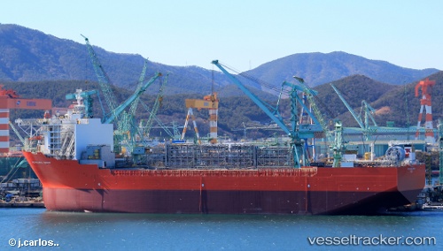
 Petrojarl Knarr
Current Status
Where is the vessel?
Petrojarl Knarr is currently in 44 nm NE of Foinaven, based on AIS data received about 15h ago.
Latest AIS update:
Current position: 60.99871° N, 3.77619° W (44 nm NE of Foinaven)
Average speed (last 7 days): Loading…
Average speed (last 30 days): Loading…
Vessel profile: Petrojarl Knarr is a Offshore Support Vessel with dimensions 244m x 48m.
This page combines live AIS, route history, probable destination signals, nearby traffic, and port activity for practical vessel monitoring.
The current position of vessel Petrojarl Knarr is 60.99871 lat / -3.77619 lng. Updated: 2026-07-09 07:47:47 UTCNearest reference points:
- 36 nm NW of Ham Voe, Foula
- 32 nm NW of Eshaness
- Near Tingwall
Currently sailing under the flag of Bahamas ![]()
Details:
Live Vessel Petrojarl Knarr Analytics (details, animations, etc.)
Recent AIS points (UTC):
2026-07-08 22:20:00 UTC · 60.99833, -3.77500 · SOG 0 kn · COG -1°2026-07-08 23:17:01 UTC · 60.99833, -3.77500 · SOG 0 kn · COG -1°
2026-07-09 00:11:00 UTC · 60.99833, -3.77500 · SOG 0 kn · COG -1°
2026-07-09 07:47:47 UTC · 60.99871, -3.77619 · SOG 0 kn · COG 235°