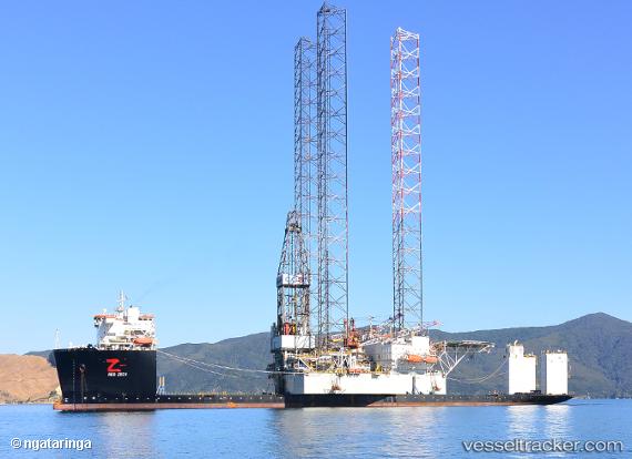
Red Zed I
Current StatusWhere is the vessel?
Red Zed I is currently in 143 nm E of Tan Cang Qui Nhon, based on AIS data received about 1d ago.
Latest AIS update:
Current position: 14.33515° N, 112.21111° E (143 nm E of Tan Cang Qui Nhon)
Average speed (last 7 days): Loading…
Average speed (last 30 days): Loading…
Vessel profile: Red Zed I is a Heavy Load Carrier with dimensions 43m x 217m.
This page combines live AIS, route history, probable destination signals, nearby traffic, and port activity for practical vessel monitoring.
The current position of vessel Red Zed I is 14.33515 lat / 112.21111 lng. Updated: 2026-05-20 16:19:26 UTCNearest reference points:
- 215 nm NE of Tan Cang Qui Nhon
- 222 nm E of Tan Cang Qui Nhon
- 232 nm E of Tan Cang Qui Nhon
Details:
Live Vessel Red Zed I Analytics (details, animations, etc.)
Recent AIS points (UTC):
2026-05-20 16:19:26 UTC · 14.33515, 112.21111 · SOG 9.1 kn · COG 190°2026-05-20 16:19:26 UTC · 14.33515, 112.21111 · SOG 9.1 kn · COG 190°
2026-05-20 16:19:26 UTC · 14.33515, 112.21111 · SOG 9.1 kn · COG 190°
2026-05-20 16:19:26 UTC · 14.33515, 112.21111 · SOG 9.1 kn · COG 190°