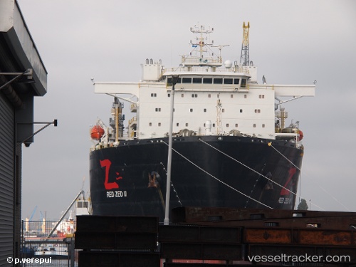
 Red Zed Ii
Current Status
Where is the vessel?
Red Zed Ii is currently in 45 nm NW of Conakry, based on AIS data received about 16h ago.
Latest AIS update:
Current position: 9.81541° N, 14.41441° W (45 nm NW of Conakry)
Average speed (last 7 days): Loading…
Average speed (last 30 days): Loading…
Vessel profile: Red Zed Ii is a Heavy Load Carrier with dimensions 217m x 43m.
This page combines live AIS, route history, probable destination signals, nearby traffic, and port activity for practical vessel monitoring.
The current position of vessel Red Zed Ii is 9.81541 lat / -14.41441 lng. Updated: 2026-06-14 19:32:00 UTCNearest reference points:
- 49 nm S of Port de Boké
- 14 nm S of Port de Boké
- Near Port de Boké
Currently sailing under the flag of Liberia ![]()
Details:
Live Vessel Red Zed Ii Analytics (details, animations, etc.)
Recent AIS points (UTC):
2026-06-14 17:07:17 UTC · 9.81551, -14.41433 · SOG 0 kn · COG 185°2026-06-14 17:58:16 UTC · 9.81547, -14.41448 · SOG 0 kn · COG 190°
2026-06-14 19:08:06 UTC · 9.81547, -14.41447 · SOG 0.1 kn · COG -1°
2026-06-14 19:32:00 UTC · 9.81541, -14.41441 · SOG 0.1 kn · COG -1°