 vesseltracker.com
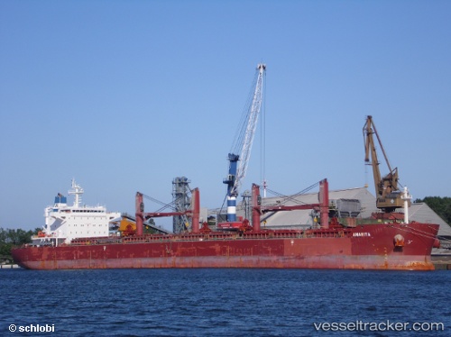
 Anarita
Current Status
Where is the vessel?
Anarita is currently in 10 nm W of Serpentina Terminal, based on AIS data received less than 1h ago.
Latest AIS update:
Current position: 3.77899° N, 7.91261° E (10 nm W of Serpentina Terminal)
Average speed (last 7 days): Loading…
Average speed (last 30 days): Loading…
Vessel profile: Anarita is a Bulk Carrier with dimensions 190m x 33m.
This page combines live AIS, route history, probable destination signals, nearby traffic, and port activity for practical vessel monitoring.
The current position of vessel Anarita is 3.77899 lat / 7.91261 lng. Updated: 2026-04-25 19:43:11 UTCNearest reference points:
- Near Odudu Terminal
- 12 nm SE of Okono
- Near Moudi Terminal
Currently sailing under the flag of Liberia ![]()
Anarita built in 2012 year
Deadweight:
58018 tDetails:
Live Vessel Anarita Analytics (details, animations, etc.)
Recent AIS points (UTC):
2026-04-25 16:23:22 UTC · 3.88865, 7.26850 · SOG 12 kn · COG 109°2026-04-25 17:37:02 UTC · 3.81868, 7.50124 · SOG 11.9 kn · COG 108°
2026-04-25 19:17:19 UTC · 3.77749, 7.82536 · SOG 11.9 kn · COG 87°
2026-04-25 19:43:11 UTC · 3.77899, 7.91261 · SOG 12 kn · COG 88°