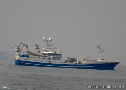
Cattleya
Current StatusWhere is the vessel?
Cattleya is currently in Near Esbjerg, based on AIS data received about 14h ago.
Latest AIS update:
Current position: 55.46896° N, 8.43287° E (Near Esbjerg)
Average speed (last 7 days): Loading…
Average speed (last 30 days): Loading…
Vessel profile: Cattleya is a Fish Carrier with dimensions 14m x 70m.
This page combines live AIS, route history, probable destination signals, nearby traffic, and port activity for practical vessel monitoring.
The current position of vessel Cattleya is 55.46896 lat / 8.43287 lng. Updated: 2026-05-19 12:01:33 UTCNearest reference points:
- Near Esbjerg
- Near Fanoe
- Near Blavand
Details:
Live Vessel Cattleya Analytics (details, animations, etc.)
Recent AIS points (UTC):
2026-05-19 08:04:43 UTC · 55.46896, 8.43285 · SOG 0 kn · COG 323°2026-05-19 10:07:14 UTC · 55.46895, 8.43287 · SOG 0 kn · COG 323°
2026-05-19 10:28:05 UTC · 55.46896, 8.43287 · SOG 0 kn · COG 323°
2026-05-19 12:01:33 UTC · 55.46896, 8.43287 · SOG 0 kn · COG 322°