Iss Breeze
Current StatusWhere is the vessel?
Iss Breeze is currently in 34 nm W of Seaview, based on AIS data received about 15h ago.
Latest AIS update:
Current position: 46.33199° N, 124.86144° W (34 nm W of Seaview)
Average speed (last 7 days): Loading…
Average speed (last 30 days): Loading…
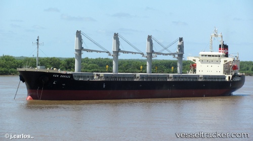
Vessel profile: Iss Breeze is a Bulk Carrier with dimensions 29m x 178m.
This page combines live AIS, route history, probable destination signals, nearby traffic, and port activity for practical vessel monitoring.
The current position of vessel Iss Breeze is 46.33199 lat / -124.86144 lng. Updated: 2026-05-20 11:58:35 UTCNearest reference points:
- Near WARRENTON
- Near Astoria
- Near Grays River
Details:
Live Vessel Iss Breeze Analytics (details, animations, etc.)
Recent AIS points (UTC):
2026-05-20 07:58:34 UTC · 46.42933, -124.85301 · SOG 1.4 kn · COG 260°2026-05-20 10:24:24 UTC · 46.37423, -124.86301 · SOG 1.8 kn · COG 255°
2026-05-20 10:57:34 UTC · 46.36045, -124.86262 · SOG 1.9 kn · COG 254°
2026-05-20 11:58:35 UTC · 46.33199, -124.86144 · SOG 1.5 kn · COG 251°