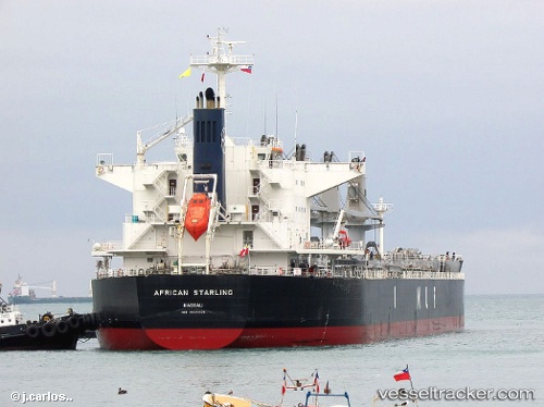
African Starling
Current StatusWhere is the vessel?
African Starling is currently in Near DONGJIAKOU, based on AIS data received about 15h ago.
Latest AIS update:
Current position: 35.61010° N, 119.79965° E (Near DONGJIAKOU)
Average speed (last 7 days): Loading…
Average speed (last 30 days): Loading…
Vessel profile: African Starling is a Bulk Carrier with dimensions 32m x 190m.
This page combines live AIS, route history, probable destination signals, nearby traffic, and port activity for practical vessel monitoring.
The current position of vessel African Starling is 35.61010 lat / 119.79965 lng. Updated: 2026-06-26 19:35:18 UTCNearest reference points:
- Near DONGJIAKOU
- Near Rizhao Pt
- 14 nm S of DONGJIAKOU
Details:
Live Vessel African Starling Analytics (details, animations, etc.)
Recent AIS points (UTC):
2026-06-26 17:08:19 UTC · 35.61005, 119.79963 · SOG 0.4 kn · COG 1°2026-06-26 17:59:17 UTC · 35.61014, 119.79967 · SOG 0.1 kn · COG 1°
2026-06-26 19:35:18 UTC · 35.61010, 119.79965 · SOG 0.1 kn · COG 1°
2026-06-26 19:35:18 UTC · 35.61010, 119.79965 · SOG 0.1 kn · COG 1°