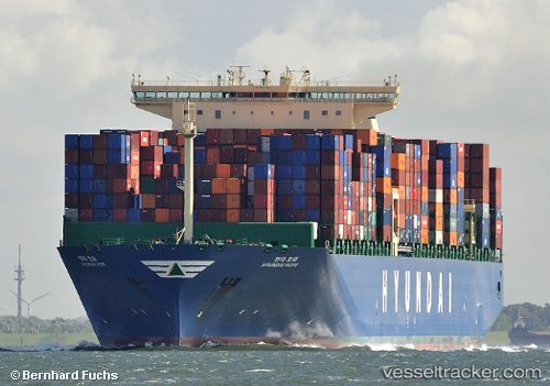
 HYUNDAI HOPE
Current Status
Where is the vessel?
HYUNDAI HOPE is currently in 87 nm W of Oga, based on AIS data received about 15h ago.
Latest AIS update:
Current position: 39.97847° N, 137.95343° E (87 nm W of Oga)
Average speed (last 7 days): Loading…
Average speed (last 30 days): Loading…
Vessel profile: HYUNDAI HOPE is a Container Ship with dimensions 48m x 366m.
This page combines live AIS, route history, probable destination signals, nearby traffic, and port activity for practical vessel monitoring.
The current position of vessel HYUNDAI HOPE is 39.97847 lat / 137.95343 lng. Updated: 2026-07-09 02:19:08 UTCNearest reference points:
- 63 nm NW of Sado Shima Apt
Currently sailing under the flag of Korea (Republic of) ![]()
HYUNDAI HOPE built in 2014 year
Deadweight:
145683 tDetails:
Live Vessel HYUNDAI HOPE Analytics (details, animations, etc.)
Recent AIS points (UTC):
2026-07-08 23:06:14 UTC · 39.38743, 136.99062 · SOG 17.4 kn · COG 55°2026-07-09 00:03:26 UTC · 39.55480, 137.28038 · SOG 17.6 kn · COG 50°
2026-07-09 02:18:38 UTC · 39.97696, 137.95085 · SOG 18 kn · COG 52°
2026-07-09 02:19:08 UTC · 39.97847, 137.95343 · SOG 18 kn · COG 52°