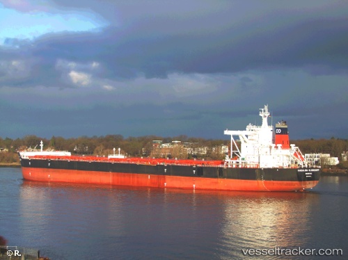
Magdalena Oldendorff
Current StatusWhere is the vessel?
Magdalena Oldendorff is currently in 51 nm E of JINHAI HEAVY INDUSTR, based on AIS data received about 14h ago.
Latest AIS update:
Current position: 30.02582° N, 123.19820° E (51 nm E of JINHAI HEAVY INDUSTR)
Average speed (last 7 days): Loading…
Average speed (last 30 days): Loading…
Vessel profile: Magdalena Oldendorff is a Bulk Carrier with dimensions 50m x 300m.
This page combines live AIS, route history, probable destination signals, nearby traffic, and port activity for practical vessel monitoring.
The current position of vessel Magdalena Oldendorff is 30.02582 lat / 123.19820 lng. Updated: 2026-05-21 07:49:02 UTCNearest reference points:
- 51 nm E of ZHOUSHAN
- 45 nm E of JINHAI HEAVY INDUSTR
- 44 nm E of JINHAI HEAVY INDUSTR
Details:
Live Vessel Magdalena Oldendorff Analytics (details, animations, etc.)
Recent AIS points (UTC):
2026-05-21 04:02:54 UTC · 29.37387, 123.23908 · SOG 11.8 kn · COG 7°2026-05-21 05:44:03 UTC · 29.64460, 123.22923 · SOG 9.8 kn · COG 356°
2026-05-21 07:13:13 UTC · 29.91609, 123.20722 · SOG 11.1 kn · COG 355°
2026-05-21 07:49:02 UTC · 30.02582, 123.19820 · SOG 10.8 kn · COG 355°