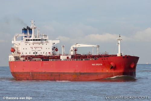
 Nave Atropos
Current Status
Where is the vessel?
Nave Atropos is currently in Near Daesan/Seosan, based on AIS data received about 14h ago.
Latest AIS update:
Current position: 37.00449° N, 126.33185° E (Near Daesan/Seosan)
Average speed (last 7 days): Loading…
Average speed (last 30 days): Loading…
Vessel profile: Nave Atropos is a Crude Oil Tanker with dimensions 228m x 32m.
This page combines live AIS, route history, probable destination signals, nearby traffic, and port activity for practical vessel monitoring.
The current position of vessel Nave Atropos is 37.00449 lat / 126.33185 lng. Updated: 2026-05-21 00:22:43 UTCNearest reference points:
- Near DAESAN
- 10 nm N of DAESAN
- 14 nm SW of Incheon
Currently sailing under the flag of Marshall Is ![]()
Details:
Live Vessel Nave Atropos Analytics (details, animations, etc.)
Recent AIS points (UTC):
2026-05-20 18:22:04 UTC · 36.63267, 125.94923 · SOG 6.9 kn · COG 22°2026-05-20 21:31:04 UTC · 36.86215, 126.09984 · SOG 4 kn · COG 84°
2026-05-20 22:54:03 UTC · 37.00853, 126.31263 · SOG 6 kn · COG 66°
2026-05-21 00:22:43 UTC · 37.00449, 126.33185 · SOG 0 kn · COG 63°