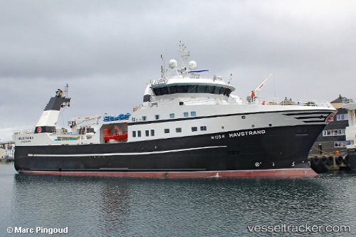
 Havstrand
Current Status
Where is the vessel?
Havstrand is currently in 52 nm NW of Thistle Field, based on AIS data received about 15h ago.
Latest AIS update:
Current position: 62.25606° N, 0.72140° E (52 nm NW of Thistle Field)
Average speed (last 7 days): Loading…
Average speed (last 30 days): Loading…
Vessel profile: Havstrand is a Fishing Vessel with dimensions 69m x 15m.
This page combines live AIS, route history, probable destination signals, nearby traffic, and port activity for practical vessel monitoring.
The current position of vessel Havstrand is 62.25606 lat / 0.72140 lng. Updated: 2026-06-16 11:41:57 UTCCurrently sailing under the flag of Norway ![]()
Havstrand built in 2013 year
Deadweight:
1900 tDetails:
Live Vessel Havstrand Analytics (details, animations, etc.)
Recent AIS points (UTC):
2026-06-16 07:57:57 UTC · 62.32774, 0.86733 · SOG 2.8 kn · COG 229°2026-06-16 09:43:53 UTC · 62.28740, 0.75283 · SOG 1 kn · COG 212°
2026-06-16 10:05:59 UTC · 62.28030, 0.75487 · SOG 4 kn · COG 47°
2026-06-16 11:41:57 UTC · 62.25606, 0.72140 · SOG 2.6 kn · COG 223°