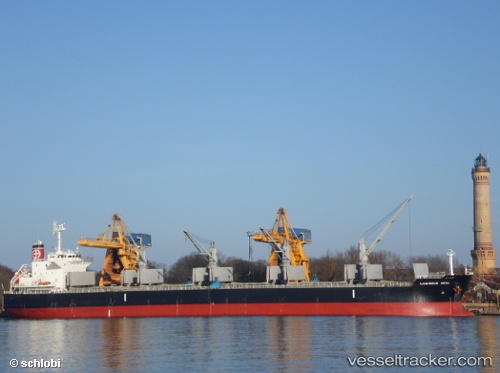
 JAG RAJIV
Current Status
Where is the vessel?
JAG RAJIV is currently in Near Mumbai, based on AIS data received about 14h ago.
Latest AIS update:
Current position: 18.87877° N, 72.85462° E (Near Mumbai)
Average speed (last 7 days): Loading…
Average speed (last 30 days): Loading…
Vessel profile: JAG RAJIV is a Bulk Carrier with dimensions 32m x 190m.
This page combines live AIS, route history, probable destination signals, nearby traffic, and port activity for practical vessel monitoring.
The current position of vessel JAG RAJIV is 18.87877 lat / 72.85462 lng. Updated: 2026-05-20 15:30:18 UTCNearest reference points:
- Near Mumbai
- Near HNB SEZ/Mumbai
- Near NHAVA SHEVA
Currently sailing under the flag of India ![]()
JAG RAJIV built in 2013 year
Deadweight:
56103 tDetails:
Live Vessel JAG RAJIV Analytics (details, animations, etc.)
Recent AIS points (UTC):
2026-05-20 11:42:20 UTC · 18.87753, 72.85275 · SOG 0.1 kn · COG 10°2026-05-20 13:33:20 UTC · 18.87721, 72.85251 · SOG 0.1 kn · COG 21°
2026-05-20 13:36:21 UTC · 18.87720, 72.85262 · SOG 0 kn · COG 14°
2026-05-20 15:30:18 UTC · 18.87877, 72.85462 · SOG 0 kn · COG 273°