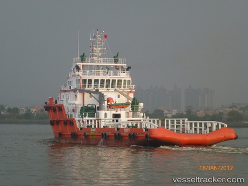
Rawabi 2
Current StatusWhere is the vessel?
Rawabi 2 is currently in 29 nm NE of Ras Tannurah, based on AIS data received about 14h ago.
Latest AIS update:
Current position: 26.97557° N, 50.56748° E (29 nm NE of Ras Tannurah)
Average speed (last 7 days): Loading…
Average speed (last 30 days): Loading…
Vessel profile: Rawabi 2 is a Offshore Tug Supply Ship with dimensions 15m x 60m.
This page combines live AIS, route history, probable destination signals, nearby traffic, and port activity for practical vessel monitoring.
The current position of vessel Rawabi 2 is 26.97557 lat / 50.56748 lng. Updated: 2026-07-06 22:24:33 UTCNearest reference points:
- Near Ad Dammam
- Near DAMMAM
- Near Qalali
Details:
Live Vessel Rawabi 2 Analytics (details, animations, etc.)
Recent AIS points (UTC):
2026-07-06 18:59:51 UTC · 26.97602, 50.56773 · SOG 0 kn · COG 349°2026-07-06 21:03:42 UTC · 26.97556, 50.56746 · SOG 0.1 kn · COG 289°
2026-07-06 21:05:01 UTC · 26.97557, 50.56748 · SOG 0 kn · COG 289°
2026-07-06 22:24:33 UTC · 26.97557, 50.56748 · SOG 0 kn · COG 289°