 PRINCESS ANNA
Current Status
Where is the vessel?
PRINCESS ANNA is currently in Near Cardiff, based on AIS data received about 14h ago.
Latest AIS update:
Current position: 51.45851° N, 3.15688° W (Near Cardiff)
Average speed (last 7 days): Loading…
Average speed (last 30 days): Loading…
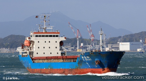
Vessel profile: PRINCESS ANNA is a General Cargo Ship with dimensions 18m x 108m.
This page combines live AIS, route history, probable destination signals, nearby traffic, and port activity for practical vessel monitoring.
The current position of vessel PRINCESS ANNA is 51.45851 lat / -3.15688 lng. Updated: 2026-07-09 04:19:43 UTCNearest reference points:
- Near Penarth
- Near Leckwith
- Near Bird Port
Currently sailing under the flag of Barbados ![]()
PRINCESS ANNA built in 2012 year
Deadweight:
7541 tDetails:
Live Vessel PRINCESS ANNA Analytics (details, animations, etc.)
Recent AIS points (UTC):
2026-07-09 00:37:10 UTC · 51.45855, -3.15686 · SOG 0 kn · COG 217°2026-07-09 02:28:13 UTC · 51.45833, -3.15667 · SOG 0 kn · COG -1°
2026-07-09 02:46:14 UTC · 51.45833, -3.15667 · SOG 0 kn · COG -1°
2026-07-09 04:19:43 UTC · 51.45851, -3.15688 · SOG 0 kn · COG 217°