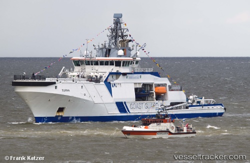
Turva
Current StatusWhere is the vessel?
Turva is currently in Near Lappohja (Lappvik), based on AIS data received about 5d ago.
Latest AIS update:
Current position: 59.89955° N, 23.26133° E (Near Lappohja (Lappvik))
Average speed (last 7 days): Loading…
Average speed (last 30 days): Loading…
Vessel profile: Turva is a Patrol Vessel with dimensions 17m x 96m.
This page combines live AIS, route history, probable destination signals, nearby traffic, and port activity for practical vessel monitoring.
The current position of vessel Turva is 59.89955 lat / 23.26133 lng. Updated: 2026-05-15 07:45:28 UTCNearest reference points:
- Near Tvärminne
- Near Hango
- Near Mahu Sadam
Details:
Live Vessel Turva Analytics (details, animations, etc.)
Recent AIS points (UTC):
2026-05-15 07:45:28 UTC · 59.89955, 23.26133 · SOG 0 kn · COG 44°2026-05-15 07:45:28 UTC · 59.89955, 23.26133 · SOG 0 kn · COG 44°
2026-05-15 07:45:28 UTC · 59.89955, 23.26133 · SOG 0 kn · COG 44°
2026-05-15 07:45:28 UTC · 59.89955, 23.26133 · SOG 0 kn · COG 44°
2026-05-15 07:45:28 UTC · 59.89955, 23.26133 · SOG 0 kn · COG 44°