 GEORGE
Current Status
Where is the vessel?
GEORGE is currently in 354 nm NE of Levelwood, based on AIS data received about 6d ago.
Latest AIS update:
Current position: 11.22282° S, 1.15077° W (354 nm NE of Levelwood)
Average speed (last 7 days): Loading…
Average speed (last 30 days): Loading…
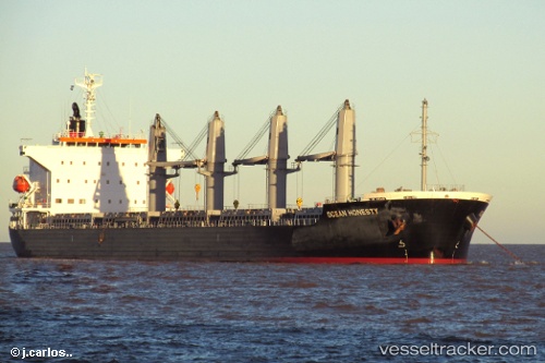
Vessel profile: GEORGE is a Bulk Carrier with dimensions 30m x 180m.
This page combines live AIS, route history, probable destination signals, nearby traffic, and port activity for practical vessel monitoring.
The current position of vessel GEORGE is -11.22282 lat / -1.15077 lng. Updated: 2026-06-08 01:25:18 UTCNearest reference points:
- Open sea, approx. 400 nm off the nearest listed port
- Open sea, approx. 403 nm off the nearest listed port
- Open sea, approx. 401 nm off the nearest listed port
Currently sailing under the flag of Marshall Islands ![]()
GEORGE built in 2013 year
Deadweight:
38276 tDetails:
Live Vessel GEORGE Analytics (details, animations, etc.)
Recent AIS points (UTC):
2026-06-08 01:25:18 UTC · -11.22282, -1.15077 · SOG 11.7 kn · COG 140°2026-06-08 01:25:18 UTC · -11.22282, -1.15077 · SOG 11.7 kn · COG 140°
2026-06-08 01:25:18 UTC · -11.22282, -1.15077 · SOG 11.7 kn · COG 140°
2026-06-08 01:25:18 UTC · -11.22282, -1.15077 · SOG 11.7 kn · COG 140°