 RUMA
RUMA
Current Status
Where is the vessel?
RUMA is currently in Near Cueva Bermeja, based on AIS data received about 15h ago.
Latest AIS update:
Current position: 28.48505° N, 16.22400° W (Near Cueva Bermeja)
Average speed (last 7 days): Loading…
Average speed (last 30 days): Loading…
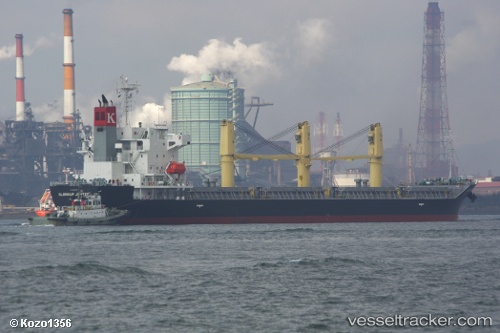
Vessel profile: RUMA is a Bulk Carrier with dimensions m x m.
This page combines live AIS, route history, probable destination signals, nearby traffic, and port activity for practical vessel monitoring.
The current position of vessel RUMA is 28.48505 lat / -16.22400 lng. Updated: 2026-05-20 11:39:11 UTCNearest reference points:
- Near San Nicolás
- Near Las Galletas
- Near LOS CRISTIANOS
Currently sailing under the flag of Portugal ![]()
Details:
Live Vessel RUMA Analytics (details, animations, etc.)
Recent AIS points (UTC):
2026-05-20 07:27:14 UTC · 28.48505, -16.22403 · SOG 0.1 kn · COG 233°2026-05-20 09:51:13 UTC · 28.48505, -16.22398 · SOG 0 kn · COG 232°
2026-05-20 10:33:10 UTC · 28.48507, -16.22400 · SOG 0 kn · COG 232°
2026-05-20 11:39:11 UTC · 28.48505, -16.22400 · SOG 0.1 kn · COG 232°