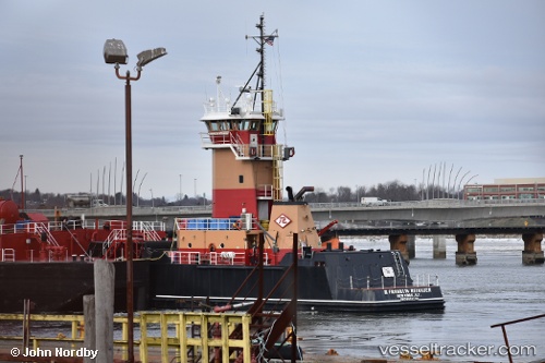
 B. Franklin Reinauer
Current Status
Where is the vessel?
B. Franklin Reinauer is currently in 16 nm S of JUDITH POINT, based on AIS data received about 14h ago.
Latest AIS update:
Current position: 41.11776° N, 71.46340° W (16 nm S of JUDITH POINT)
Average speed (last 7 days): Loading…
Average speed (last 30 days): Loading…
Vessel profile: B. Franklin Reinauer is a Pusher Tug with dimensions 132m x 24m.
This page combines live AIS, route history, probable destination signals, nearby traffic, and port activity for practical vessel monitoring.
The current position of vessel B. Franklin Reinauer is 41.11776 lat / -71.46340 lng. Updated: 2026-05-22 04:35:14 UTCNearest reference points:
- Near JUDITH POINT
- Near Newport
- Near MELVILLE
Currently sailing under the flag of USA ![]()
B. Franklin Reinauer built in 2012 year
Deadweight:
526 tDetails:
Live Vessel B. Franklin Reinauer Analytics (details, animations, etc.)
Recent AIS points (UTC):
2026-05-22 02:11:56 UTC · 40.97131, -71.89467 · SOG 9.1 kn · COG 73°2026-05-22 02:12:28 UTC · 40.97178, -71.89305 · SOG 9.1 kn · COG 73°
2026-05-22 03:48:48 UTC · 41.07108, -71.59817 · SOG 9.2 kn · COG 67°
2026-05-22 04:35:14 UTC · 41.11776, -71.46340 · SOG 6.3 kn · COG 56°