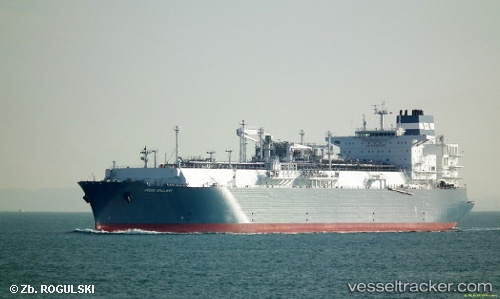
Hoegh Gallant
Current StatusWhere is the vessel?
Hoegh Gallant is currently in Near Old Harbour, based on AIS data received about 15h ago.
Latest AIS update:
Current position: 17.84480° N, 77.11707° W (Near Old Harbour)
Average speed (last 7 days): Loading…
Average speed (last 30 days): Loading…
Vessel profile: Hoegh Gallant is a Fsru Tanker with dimensions 46m x 294m.
This page combines live AIS, route history, probable destination signals, nearby traffic, and port activity for practical vessel monitoring.
The current position of vessel Hoegh Gallant is 17.84480 lat / -77.11707 lng. Updated: 2026-05-25 23:52:36 UTCNearest reference points:
- 16 nm SE of Ceiba Hueca
Details:
Live Vessel Hoegh Gallant Analytics (details, animations, etc.)
Recent AIS points (UTC):
2026-05-25 19:46:30 UTC · 17.84483, -77.11705 · SOG 0 kn · COG 135°2026-05-25 21:37:55 UTC · 17.84479, -77.11704 · SOG 0 kn · COG -1°
2026-05-25 22:59:37 UTC · 17.84333, -77.11666 · SOG 0 kn · COG -1°
2026-05-25 23:52:36 UTC · 17.84480, -77.11707 · SOG 0 kn · COG 135°