 ASTRO SCORPIUS
Current Status
Where is the vessel?
ASTRO SCORPIUS is currently in Near Al Hamriyah, based on AIS data received about 23h ago.
Latest AIS update:
Current position: 25.47110° N, 55.51035° E (Near Al Hamriyah)
Average speed (last 7 days): Loading…
Average speed (last 30 days): Loading…
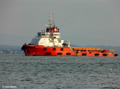
Vessel profile: ASTRO SCORPIUS is a Offshore Tug/Supply Ship with dimensions 16m x 60m.
This page combines live AIS, route history, probable destination signals, nearby traffic, and port activity for practical vessel monitoring.
The current position of vessel ASTRO SCORPIUS is 25.47110 lat / 55.51035 lng. Updated: 2026-07-09 07:17:38 UTCNearest reference points:
- Near Al Hamriyah
- Near AJMAN
- Near Sharjah
Currently sailing under the flag of Singapore ![]()
ASTRO SCORPIUS built in 2012 year
Deadweight:
1767 tDetails:
Live Vessel ASTRO SCORPIUS Analytics (details, animations, etc.)
Recent AIS points (UTC):
2026-07-09 03:50:34 UTC · 25.47110, 55.51035 · SOG 0 kn · COG 25°2026-07-09 05:05:35 UTC · 25.47111, 55.51034 · SOG 0 kn · COG 25°
2026-07-09 05:56:32 UTC · 25.47110, 55.51035 · SOG 0 kn · COG 24°
2026-07-09 07:17:38 UTC · 25.47110, 55.51035 · SOG 0 kn · COG 25°