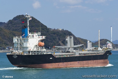
Laluan
Current StatusWhere is the vessel?
Laluan is currently in Near Kawasaki, based on AIS data received about 14h ago.
Latest AIS update:
Current position: 35.50916° N, 139.75214° E (Near Kawasaki)
Average speed (last 7 days): Loading…
Average speed (last 30 days): Loading…
Vessel profile: Laluan is a General Cargo Ship with dimensions 20m x 118m.
This page combines live AIS, route history, probable destination signals, nearby traffic, and port activity for practical vessel monitoring.
The current position of vessel Laluan is 35.50916 lat / 139.75214 lng. Updated: 2026-05-20 11:25:31 UTCNearest reference points:
- Near Kawasaki
- Near Aomi
- Near Yokohama
Details:
Live Vessel Laluan Analytics (details, animations, etc.)
Recent AIS points (UTC):
2026-05-20 07:51:53 UTC · 35.50914, 139.75221 · SOG 0 kn · COG 118°2026-05-20 10:05:13 UTC · 35.50912, 139.75220 · SOG 0.1 kn · COG 118°
2026-05-20 10:12:01 UTC · 35.50912, 139.75221 · SOG 0.1 kn · COG 118°
2026-05-20 11:25:31 UTC · 35.50916, 139.75214 · SOG 0 kn · COG 118°