 An Tai Shan
Current Status
Where is the vessel?
An Tai Shan is currently in Near Bozhong, based on AIS data received about 14h ago.
Latest AIS update:
Current position: 38.46043° N, 118.35293° E (Near Bozhong)
Average speed (last 7 days): Loading…
Average speed (last 30 days): Loading…
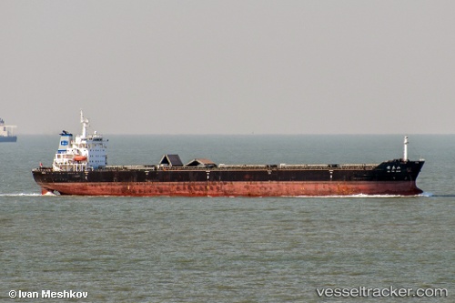
Vessel profile: An Tai Shan is a Bulk Carrier with dimensions 199m x 199m.
This page combines live AIS, route history, probable destination signals, nearby traffic, and port activity for practical vessel monitoring.
The current position of vessel An Tai Shan is 38.46043 lat / 118.35293 lng. Updated: 2026-07-09 04:04:21 UTCNearest reference points:
- 12 nm W of Bozhong
- 13 nm NE of HUANGHUA
- 11 nm NE of HUANGHUA
Currently sailing under the flag of China ![]()
Details:
Live Vessel An Tai Shan Analytics (details, animations, etc.)
Recent AIS points (UTC):
2026-07-09 00:05:28 UTC · 38.46072, 118.35270 · SOG 0.4 kn · COG 268°2026-07-09 01:53:56 UTC · 38.45948, 118.35277 · SOG 0 kn · COG -1°
2026-07-09 02:49:01 UTC · 38.45962, 118.35278 · SOG 0.1 kn · COG -1°
2026-07-09 04:04:21 UTC · 38.46043, 118.35293 · SOG 0 kn · COG 257°