 JB 120
Current Status
Where is the vessel?
JB 120 is currently in 14 nm N of Craven Arms, based on AIS data received about 14h ago.
Latest AIS update:
Current position: 52.67061° N, 2.86426° E (14 nm N of Craven Arms)
Average speed (last 7 days): Loading…
Average speed (last 30 days): Loading…
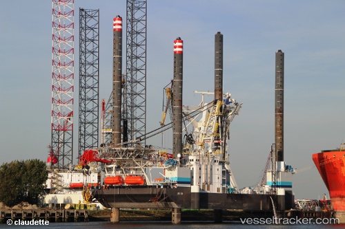
Vessel profile: JB 120 is a Support Jack Up with dimensions m x m.
This page combines live AIS, route history, probable destination signals, nearby traffic, and port activity for practical vessel monitoring.
The current position of vessel JB 120 is 52.67061 lat / 2.86426 lng. Updated: 2026-05-20 22:00:11 UTCNearest reference points:
- Near Craven Arms
- 24 nm NE of Caister on Sea
- 21 nm S of Craven Arms
Currently sailing under the flag of Bahamas ![]()
Details:
Live Vessel JB 120 Analytics (details, animations, etc.)
Recent AIS points (UTC):
2026-05-20 16:24:44 UTC · 52.67055, 2.86437 · SOG 0 kn · COG 110°2026-05-20 17:36:44 UTC · 52.67056, 2.86428 · SOG 0 kn · COG 110°
2026-05-20 19:03:42 UTC · 52.67058, 2.86429 · SOG 0 kn · COG 110°
2026-05-20 22:00:11 UTC · 52.67061, 2.86426 · SOG 0 kn · COG 110°