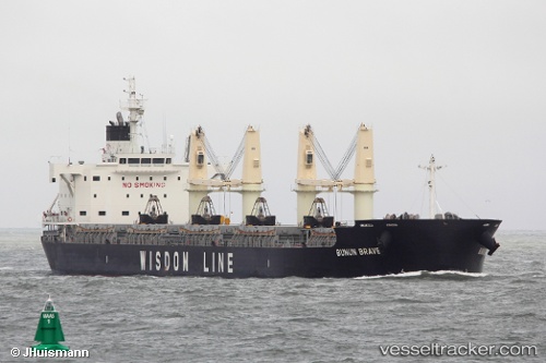
 TRINIDAD PEARL
Current Status
Where is the vessel?
TRINIDAD PEARL is currently in 69 nm N of Ben Slimane, based on AIS data received about 14h ago.
Latest AIS update:
Current position: 34.72512° N, 70.91332° W (69 nm N of Ben Slimane)
Average speed (last 7 days): Loading…
Average speed (last 30 days): Loading…
Vessel profile: TRINIDAD PEARL is a Cargo B with dimensions m x m.
This page combines live AIS, route history, probable destination signals, nearby traffic, and port activity for practical vessel monitoring.
The current position of vessel TRINIDAD PEARL is 34.72512 lat / -70.91332 lng. Updated: 2026-06-13 10:08:36 UTCNearest reference points:
- 169 nm NE of Ben Slimane
Currently sailing under the flag of Bahamas ![]()
Details:
Live Vessel TRINIDAD PEARL Analytics (details, animations, etc.)
Recent AIS points (UTC):
2026-06-13 07:22:16 UTC · 34.28459, -71.33223 · SOG 12.1 kn · COG 37°2026-06-13 07:45:48 UTC · 34.34732, -71.27404 · SOG 12.3 kn · COG 39°
2026-06-13 09:28:09 UTC · 34.61841, -71.01470 · SOG 11.8 kn · COG 37°
2026-06-13 10:08:36 UTC · 34.72512, -70.91332 · SOG 12.1 kn · COG 38°