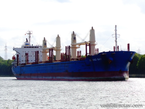
Island Bay
Current StatusWhere is the vessel?
Island Bay is currently in 42 nm S of San Juan, based on AIS data received about 14h ago.
Latest AIS update:
Current position: 16.02303° S, 75.00265° W (42 nm S of San Juan)
Average speed (last 7 days): Loading…
Average speed (last 30 days): Loading…
Vessel profile: Island Bay is a Bulk Carrier with dimensions 30m x 180m.
This page combines live AIS, route history, probable destination signals, nearby traffic, and port activity for practical vessel monitoring.
The current position of vessel Island Bay is -16.02303 lat / -75.00265 lng. Updated: 2026-05-21 07:58:19 UTCNearest reference points:
- 110 nm SW of San Juan
Details:
Live Vessel Island Bay Analytics (details, animations, etc.)
Recent AIS points (UTC):
2026-05-21 04:34:42 UTC · -15.47275, -75.55713 · SOG 12.6 kn · COG 136°2026-05-21 06:31:32 UTC · -15.78762, -75.24549 · SOG 13.8 kn · COG 134°
2026-05-21 07:32:19 UTC · -15.95260, -75.07356 · SOG 13.7 kn · COG 134°
2026-05-21 07:58:19 UTC · -16.02303, -75.00265 · SOG 13.3 kn · COG 136°