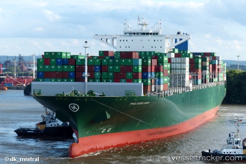
 Thalassa Doxa
Current Status
Where is the vessel?
Thalassa Doxa is currently in 37 nm E of PUERTO DEL ROSARIO, based on AIS data received about 16h ago.
Latest AIS update:
Current position: 28.38251° N, 13.16828° W (37 nm E of PUERTO DEL ROSARIO)
Average speed (last 7 days): Loading…
Average speed (last 30 days): Loading…
Vessel profile: Thalassa Doxa is a Container Ship with dimensions 368m x 51m.
This page combines live AIS, route history, probable destination signals, nearby traffic, and port activity for practical vessel monitoring.
The current position of vessel Thalassa Doxa is 28.38251 lat / -13.16828 lng. Updated: 2026-06-17 10:13:03 UTCNearest reference points:
- Near Lanzarote
- Near LAS COLORADAS
- Near Aaiun
Currently sailing under the flag of Liberia ![]()
Details:
Live Vessel Thalassa Doxa Analytics (details, animations, etc.)
Recent AIS points (UTC):
2026-06-17 07:35:34 UTC · 27.80984, -13.61552 · SOG 15.5 kn · COG 36°2026-06-17 08:36:28 UTC · 28.01910, -13.43715 · SOG 15.8 kn · COG 37°
2026-06-17 10:00:22 UTC · 28.32994, -13.20571 · SOG 17.1 kn · COG 32°
2026-06-17 10:13:03 UTC · 28.38251, -13.16828 · SOG 17.7 kn · COG 31°