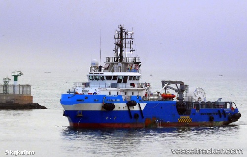
 GEO OCEAN IX
Current Status
Where is the vessel?
GEO OCEAN IX is currently in Near Burravoe, based on AIS data received about 16h ago.
Latest AIS update:
Current position: 60.45540° N, 1.08675° W (Near Burravoe)
Average speed (last 7 days): Loading…
Average speed (last 30 days): Loading…
Vessel profile: GEO OCEAN IX is a Research/Survey Vessel with dimensions m x m.
This page combines live AIS, route history, probable destination signals, nearby traffic, and port activity for practical vessel monitoring.
The current position of vessel GEO OCEAN IX is 60.45540 lat / -1.08675 lng. Updated: 2026-05-19 19:51:00 UTCNearest reference points:
- 32 nm NW of Eshaness
- 36 nm NW of Ham Voe, Foula
- Near Tingwall
Details:
Live Vessel GEO OCEAN IX Analytics (details, animations, etc.)
Recent AIS points (UTC):
2026-05-19 17:11:54 UTC · 60.46144, -1.06048 · SOG 0.9 kn · COG 168°2026-05-19 18:06:53 UTC · 60.45709, -1.09562 · SOG 1.4 kn · COG 130°
2026-05-19 19:49:31 UTC · 60.45486, -1.08904 · SOG 3.1 kn · COG 93°
2026-05-19 19:51:00 UTC · 60.45540, -1.08675 · SOG 3 kn · COG 101°