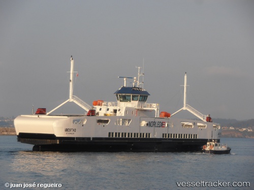
 Ibestad
Current Status
Where is the vessel?
Ibestad is currently in Near Olderdalen, based on AIS data received about 14h ago.
Latest AIS update:
Current position: 69.59919° N, 20.47778° E (Near Olderdalen)
Average speed (last 7 days): Loading…
Average speed (last 30 days): Loading…
Vessel profile: Ibestad is a Passenger Ro Ro Cargo Ship with dimensions 87m x 13m.
This page combines live AIS, route history, probable destination signals, nearby traffic, and port activity for practical vessel monitoring.
The current position of vessel Ibestad is 69.59919 lat / 20.47778 lng. Updated: 2026-05-22 06:22:46 UTCNearest reference points:
- Near Sørkjosen
- Near Skjervøy
- Near Tromsø
Currently sailing under the flag of Norway ![]()
Ibestad built in 2014 year
Deadweight:
671 tDetails:
Live Vessel Ibestad Analytics (details, animations, etc.)
Recent AIS points (UTC):
2026-05-22 02:02:33 UTC · 69.60186, 20.53148 · SOG 0 kn · COG 121°2026-05-22 03:29:34 UTC · 69.60184, 20.53143 · SOG 0 kn · COG 121°
2026-05-22 04:15:19 UTC · 69.60187, 20.53142 · SOG 0 kn · COG 122°
2026-05-22 06:22:46 UTC · 69.59919, 20.47778 · SOG 11.1 kn · COG 258°