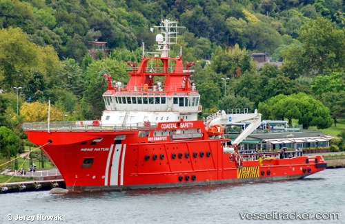
 Nene Hatun
Current Status
Where is the vessel?
Nene Hatun is currently in Near Beylerbeyi, based on AIS data received about 14h ago.
Latest AIS update:
Current position: 41.05287° N, 29.03494° E (Near Beylerbeyi)
Average speed (last 7 days): Loading…
Average speed (last 30 days): Loading…
Vessel profile: Nene Hatun is a Search And Rescue Vessel with dimensions 90m x 20m.
This page combines live AIS, route history, probable destination signals, nearby traffic, and port activity for practical vessel monitoring.
The current position of vessel Nene Hatun is 41.05287 lat / 29.03494 lng. Updated: 2026-05-20 01:50:14 UTCNearest reference points:
- Near Beylerbeyi
- Near Kabatas
- Near Arnavutköy/Istambul
Currently sailing under the flag of Turkey ![]()
Details:
Live Vessel Nene Hatun Analytics (details, animations, etc.)
Recent AIS points (UTC):
2026-05-19 22:32:46 UTC · 41.05275, 29.03478 · SOG 0 kn · COG 199°2026-05-19 23:43:02 UTC · 41.05290, 29.03461 · SOG 0.3 kn · COG 199°
2026-05-20 01:21:01 UTC · 41.05299, 29.03470 · SOG 0 kn · COG 199°
2026-05-20 01:50:14 UTC · 41.05287, 29.03494 · SOG 0 kn · COG 199°