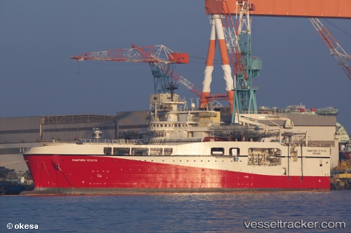
 RAMFORM TETHYS
Current Status
Where is the vessel?
RAMFORM TETHYS is currently in 194 nm SE of Tavares, based on AIS data received about 14h ago.
Latest AIS update:
Current position: 32.83189° S, 47.72558° W (194 nm SE of Tavares)
Average speed (last 7 days): Loading…
Average speed (last 30 days): Loading…
Vessel profile: RAMFORM TETHYS is a Other Type with dimensions m x m.
This page combines live AIS, route history, probable destination signals, nearby traffic, and port activity for practical vessel monitoring.
The current position of vessel RAMFORM TETHYS is -32.83189 lat / -47.72558 lng. Updated: 2026-05-22 07:46:10 UTCCurrently sailing under the flag of Bahamas ![]()
Details:
Live Vessel RAMFORM TETHYS Analytics (details, animations, etc.)
Recent AIS points (UTC):
2026-05-22 03:41:08 UTC · -32.84502, -47.38024 · SOG 4.5 kn · COG 310°2026-05-22 03:58:50 UTC · -32.83324, -47.39862 · SOG 3.5 kn · COG 290°
2026-05-22 06:23:51 UTC · -32.82812, -47.60418 · SOG 5 kn · COG 270°
2026-05-22 07:46:10 UTC · -32.83189, -47.72558 · SOG 4.7 kn · COG 264°