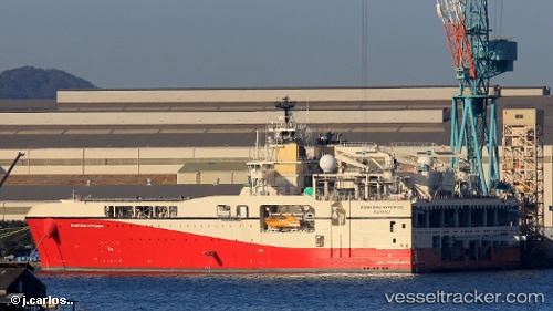
 RAMFORM HYPERION
Current Status
Where is the vessel?
RAMFORM HYPERION is currently in 27 nm S of Okwori, based on AIS data received about 15h ago.
Latest AIS update:
Current position: 3.41655° N, 6.88248° E (27 nm S of Okwori)
Average speed (last 7 days): Loading…
Average speed (last 30 days): Loading…
Vessel profile: RAMFORM HYPERION is a Other Type with dimensions m x m.
This page combines live AIS, route history, probable destination signals, nearby traffic, and port activity for practical vessel monitoring.
The current position of vessel RAMFORM HYPERION is 3.41655 lat / 6.88248 lng. Updated: 2026-05-20 11:51:17 UTCNearest reference points:
- 12 nm N of Okwori
- 12 nm SE of Okono
- 21 nm SW of Bonny
Currently sailing under the flag of Norway ![]()
Details:
Live Vessel RAMFORM HYPERION Analytics (details, animations, etc.)
Recent AIS points (UTC):
2026-05-20 08:07:55 UTC · 3.34105, 7.06274 · SOG 4.2 kn · COG 12°2026-05-20 09:40:05 UTC · 3.41644, 7.02537 · SOG 3.5 kn · COG 286°
2026-05-20 10:28:48 UTC · 3.41762, 6.97326 · SOG 3.5 kn · COG 270°
2026-05-20 11:51:17 UTC · 3.41655, 6.88248 · SOG 3.9 kn · COG 270°