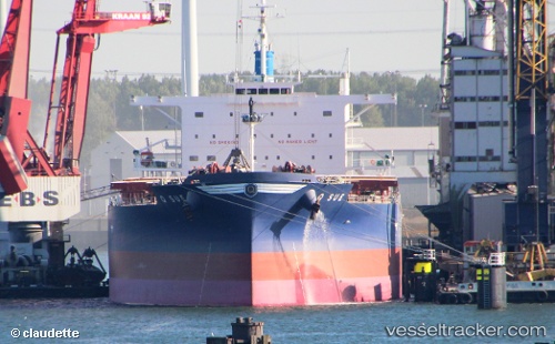
 GOLDEN SUE
Current Status
Where is the vessel?
GOLDEN SUE is currently in 140 nm W of Booby Island, based on AIS data received about 14h ago.
Latest AIS update:
Current position: 11.14837° S, 139.61179° E (140 nm W of Booby Island)
Average speed (last 7 days): Loading…
Average speed (last 30 days): Loading…
Vessel profile: GOLDEN SUE is a Bulk Carrier with dimensions m x m.
This page combines live AIS, route history, probable destination signals, nearby traffic, and port activity for practical vessel monitoring.
The current position of vessel GOLDEN SUE is -11.14837 lat / 139.61179 lng. Updated: 2026-06-22 13:21:25 UTCNearest reference points:
- Near Torres Strait
Currently sailing under the flag of Belgium ![]()
Details:
Live Vessel GOLDEN SUE Analytics (details, animations, etc.)
Recent AIS points (UTC):
2026-06-22 09:55:17 UTC · -11.56847, 140.13054 · SOG 11.4 kn · COG 307°2026-06-22 10:14:38 UTC · -11.52855, 140.08266 · SOG 11.4 kn · COG 308°
2026-06-22 12:11:15 UTC · -11.28929, 139.79234 · SOG 11.5 kn · COG 309°
2026-06-22 13:21:25 UTC · -11.14837, 139.61179 · SOG 11.7 kn · COG 309°