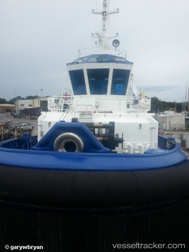
 Signet Polaris
Current Status
Where is the vessel?
Signet Polaris is currently in Near Aransas Pass, based on AIS data received about 14h ago.
Latest AIS update:
Current position: 27.84654° N, 97.22492° W (Near Aransas Pass)
Average speed (last 7 days): Loading…
Average speed (last 30 days): Loading…
Vessel profile: Signet Polaris is a Tug with dimensions 32m x 10m.
This page combines live AIS, route history, probable destination signals, nearby traffic, and port activity for practical vessel monitoring.
The current position of vessel Signet Polaris is 27.84654 lat / -97.22492 lng. Updated: 2026-07-13 22:26:58 UTCNearest reference points:
- Near Aransas Pass
- Near ARANSAS PASS
- Near PORT ARANSAS
Currently sailing under the flag of USA ![]()
Details:
Live Vessel Signet Polaris Analytics (details, animations, etc.)
Recent AIS points (UTC):
2026-07-13 19:37:50 UTC · 27.84655, -97.22490 · SOG 0.1 kn · COG 230°2026-07-13 19:48:21 UTC · 27.84655, -97.22490 · SOG 0.1 kn · COG 230°
2026-07-13 22:25:27 UTC · 27.84656, -97.22487 · SOG 0 kn · COG 230°
2026-07-13 22:26:58 UTC · 27.84654, -97.22492 · SOG 0.1 kn · COG 230°