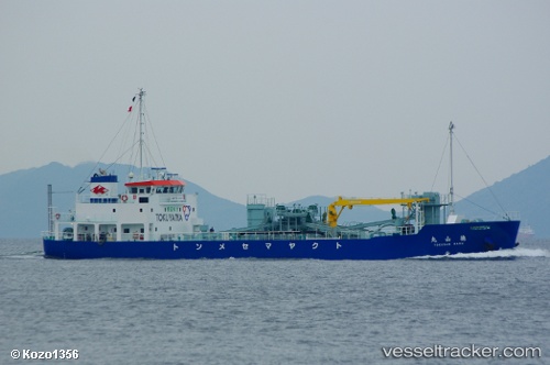
Tokusan Maru
Current StatusWhere is the vessel?
Tokusan Maru is currently in Near Shunan, based on AIS data received about 15h ago.
Latest AIS update:
Current position: 34.04427° N, 131.79123° E (Near Shunan)
Average speed (last 7 days): Loading…
Average speed (last 30 days): Loading…
Vessel profile: Tokusan Maru is a Cement Carrier with dimensions 12m x 59m.
This page combines live AIS, route history, probable destination signals, nearby traffic, and port activity for practical vessel monitoring.
The current position of vessel Tokusan Maru is 34.04427 lat / 131.79123 lng. Updated: 2026-06-29 23:23:18 UTCNearest reference points:
- Near Shunan
- Near Tokuyama
- Near KUDAMATSU
Details:
Live Vessel Tokusan Maru Analytics (details, animations, etc.)
Recent AIS points (UTC):
2026-06-29 20:11:22 UTC · 34.04427, 131.79121 · SOG 0 kn · COG 222°2026-06-29 22:08:21 UTC · 34.04427, 131.79123 · SOG 0 kn · COG 222°
2026-06-29 22:14:23 UTC · 34.04433, 131.79124 · SOG 0 kn · COG 221°
2026-06-29 23:23:18 UTC · 34.04427, 131.79123 · SOG 0 kn · COG 222°