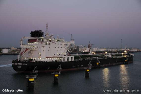
British Resolution
Current StatusWhere is the vessel?
British Resolution is currently in 291 nm N of Mutineer, based on AIS data received about 15h ago.
Latest AIS update:
Current position: 14.42542° S, 116.34009° E (291 nm N of Mutineer)
Average speed (last 7 days): Loading…
Average speed (last 30 days): Loading…
Vessel profile: British Resolution is a Crude Oil Tanker with dimensions 44m x 250m.
This page combines live AIS, route history, probable destination signals, nearby traffic, and port activity for practical vessel monitoring.
The current position of vessel British Resolution is -14.42542 lat / 116.34009 lng. Updated: 2026-05-21 05:28:58 UTCNearest reference points:
- 244 nm N of Mutineer
Details:
Live Vessel British Resolution Analytics (details, animations, etc.)
Recent AIS points (UTC):
2026-05-21 02:20:27 UTC · -13.81891, 116.27409 · SOG 11.6 kn · COG 179°2026-05-21 03:57:14 UTC · -14.12851, 116.30900 · SOG 11.6 kn · COG 178°
2026-05-21 04:13:08 UTC · -14.18024, 116.31317 · SOG 11.5 kn · COG 178°
2026-05-21 05:28:58 UTC · -14.42542, 116.34009 · SOG 11.7 kn · COG 174°