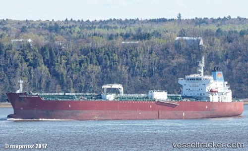
 TORM DORIS
Current Status
Where is the vessel?
TORM DORIS is currently in Near Rosarito Terminal, based on AIS data received about 15h ago.
Latest AIS update:
Current position: 32.32726° N, 117.10519° W (Near Rosarito Terminal)
Average speed (last 7 days): Loading…
Average speed (last 30 days): Loading…
Vessel profile: TORM DORIS is a Tanker with dimensions m x m.
This page combines live AIS, route history, probable destination signals, nearby traffic, and port activity for practical vessel monitoring.
The current position of vessel TORM DORIS is 32.32726 lat / -117.10519 lng. Updated: 2026-05-19 03:20:15 UTCNearest reference points:
- Near San Diego
- Near Coronado
- Near Ocean Beach
Currently sailing under the flag of Denmark ![]()
Details:
Live Vessel TORM DORIS Analytics (details, animations, etc.)
Recent AIS points (UTC):
2026-05-19 00:17:15 UTC · 32.32727, -117.10519 · SOG 0.1 kn · COG 317°2026-05-19 01:06:55 UTC · 32.32734, -117.10505 · SOG 0.1 kn · COG 318°
2026-05-19 02:23:15 UTC · 32.32729, -117.10508 · SOG 0.1 kn · COG 323°
2026-05-19 03:20:15 UTC · 32.32726, -117.10519 · SOG 0 kn · COG 329°