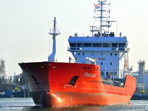
 Traviata
Current Status
Where is the vessel?
Traviata is currently in Near BRUNSBUETTEL, based on AIS data received about 14h ago.
Latest AIS update:
Current position: 53.90678° N, 9.16974° E (Near BRUNSBUETTEL)
Average speed (last 7 days): Loading…
Average speed (last 30 days): Loading…
Vessel profile: Traviata is a Chemical Oil Products Tanker with dimensions 104m x 104m.
This page combines live AIS, route history, probable destination signals, nearby traffic, and port activity for practical vessel monitoring.
The current position of vessel Traviata is 53.90678 lat / 9.16974 lng. Updated: 2026-05-20 08:06:23 UTCNearest reference points:
- Near Kiel Canal
- Near Abbenfleth
- Near Stader Sand
Currently sailing under the flag of Cyprus ![]()
Details:
Live Vessel Traviata Analytics (details, animations, etc.)
Recent AIS points (UTC):
2026-05-20 04:41:48 UTC · 53.88313, 9.10928 · SOG 0.2 kn · COG 303°2026-05-20 06:06:13 UTC · 53.88360, 9.10626 · SOG 0.4 kn · COG 97°
2026-05-20 07:44:14 UTC · 53.89427, 9.14541 · SOG 0 kn · COG 47°
2026-05-20 08:06:23 UTC · 53.90678, 9.16974 · SOG 5.6 kn · COG 47°