Alexis
Current StatusWhere is the vessel?
Alexis is currently in 165 nm W of Alozaina, based on AIS data received about 14h ago.
Latest AIS update:
Current position: 37.24144° N, 18.22113° W (165 nm W of Alozaina)
Average speed (last 7 days): Loading…
Average speed (last 30 days): Loading…
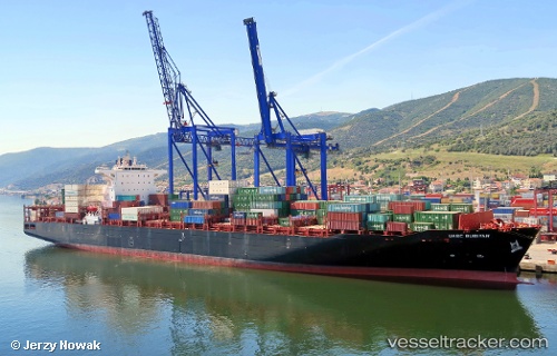
Vessel profile: Alexis is a Container Ship with dimensions 43m x 270m.
This page combines live AIS, route history, probable destination signals, nearby traffic, and port activity for practical vessel monitoring.
The current position of vessel Alexis is 37.24144 lat / -18.22113 lng. Updated: 2026-05-21 04:00:31 UTCNearest reference points:
- 150 nm NW of Ponta do Pargo
- 78 nm W of Nedroma
Details:
Live Vessel Alexis Analytics (details, animations, etc.)
Recent AIS points (UTC):
2026-05-21 01:07:41 UTC · 37.22344, -18.30343 · SOG 1.1 kn · COG 294°2026-05-21 01:50:53 UTC · 37.22833, -18.28333 · SOG 1 kn · COG -1°
2026-05-21 03:20:55 UTC · 37.23833, -18.24000 · SOG 1 kn · COG -1°
2026-05-21 04:00:31 UTC · 37.24144, -18.22113 · SOG 1.4 kn · COG 308°