 Manhattan Bridge
Current Status
Where is the vessel?
Manhattan Bridge is currently in 119 nm NW of Port Mathurin, based on AIS data received about 15h ago.
Latest AIS update:
Current position: 18.67072° S, 61.61932° E (119 nm NW of Port Mathurin)
Average speed (last 7 days): Loading…
Average speed (last 30 days): Loading…
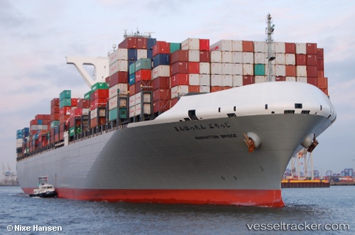
Vessel profile: Manhattan Bridge is a Container Ship with dimensions 366m x 51m.
This page combines live AIS, route history, probable destination signals, nearby traffic, and port activity for practical vessel monitoring.
The current position of vessel Manhattan Bridge is -18.67072 lat / 61.61932 lng. Updated: 2026-06-13 12:09:13 UTCNearest reference points:
- 106 nm NW of Port Mathurin
- 159 nm W of Rodrigues
- 219 nm NW of Port Mathurin
Currently sailing under the flag of Japan ![]()
Details:
Live Vessel Manhattan Bridge Analytics (details, animations, etc.)
Recent AIS points (UTC):
2026-06-13 07:49:20 UTC · -18.04081, 62.74551 · SOG 17.3 kn · COG 238°2026-06-13 10:06:41 UTC · -18.36597, 62.14307 · SOG 17.3 kn · COG 236°
2026-06-13 11:19:16 UTC · -18.54611, 61.82896 · SOG 16.8 kn · COG 234°
2026-06-13 12:09:13 UTC · -18.67072, 61.61932 · SOG 17.1 kn · COG 233°