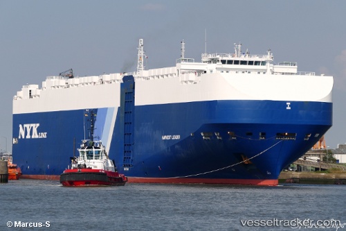
Harvest Leader
Current StatusWhere is the vessel?
Harvest Leader is currently in Near San Antonio, based on AIS data received about 15h ago.
Latest AIS update:
Current position: 33.58697° S, 71.61883° W (Near San Antonio)
Average speed (last 7 days): Loading…
Average speed (last 30 days): Loading…
Vessel profile: Harvest Leader is a Vehicles Carrier with dimensions 36m x 200m.
This page combines live AIS, route history, probable destination signals, nearby traffic, and port activity for practical vessel monitoring.
The current position of vessel Harvest Leader is -33.58697 lat / -71.61883 lng. Updated: 2026-06-22 08:05:37 UTCNearest reference points:
- Near Valparaiso
- 28 nm W of Pichilemu
- 100 nm W of Curauma
Details:
Live Vessel Harvest Leader Analytics (details, animations, etc.)
Recent AIS points (UTC):
2026-06-22 04:07:38 UTC · -33.58667, -71.61833 · SOG 0 kn · COG -1°2026-06-22 06:10:40 UTC · -33.58667, -71.61833 · SOG 0 kn · COG -1°
2026-06-22 07:14:34 UTC · -33.58697, -71.61881 · SOG 0.1 kn · COG 319°
2026-06-22 08:05:37 UTC · -33.58697, -71.61883 · SOG 0.1 kn · COG 318°