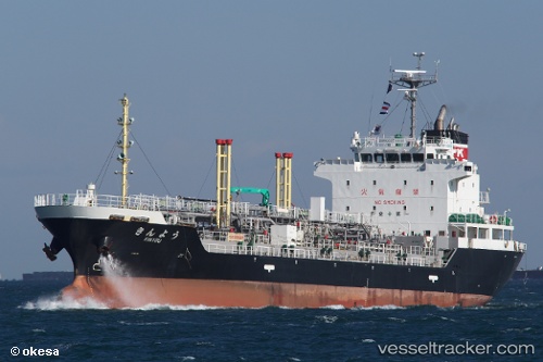
Kinyou
Current StatusWhere is the vessel?
Kinyou is currently in Near Yokosuka, based on AIS data received about 14h ago.
Latest AIS update:
Current position: 35.28198° N, 139.74962° E (Near Yokosuka)
Average speed (last 7 days): Loading…
Average speed (last 30 days): Loading…
Vessel profile: Kinyou is a Oil Products Tanker with dimensions 16m x 105m.
This page combines live AIS, route history, probable destination signals, nearby traffic, and port activity for practical vessel monitoring.
The current position of vessel Kinyou is 35.28198 lat / 139.74962 lng. Updated: 2026-05-20 21:31:16 UTCNearest reference points:
- Near Yokosuka
- Near Naka-Ku, Kanagawa
- Near Yokohama
Details:
Live Vessel Kinyou Analytics (details, animations, etc.)
Recent AIS points (UTC):
2026-05-20 17:04:43 UTC · 35.37433, 139.73663 · SOG 0.1 kn · COG 282°2026-05-20 18:19:48 UTC · 35.37516, 139.73668 · SOG 0.1 kn · COG 235°
2026-05-20 19:04:43 UTC · 35.37527, 139.73656 · SOG 0 kn · COG 223°
2026-05-20 21:31:16 UTC · 35.28198, 139.74962 · SOG 12.5 kn · COG 146°