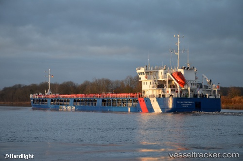
Pola Sevastiana
Current StatusWhere is the vessel?
Pola Sevastiana is currently in 36 nm NE of Maials, based on AIS data received about 15d ago.
Latest AIS update:
Current position: 41.83862° N, 30.79056° E (36 nm NE of Maials)
Average speed (last 7 days): Loading…
Average speed (last 30 days): Loading…
Vessel profile: Pola Sevastiana is a General Cargo Ship with dimensions 17m x 140m.
This page combines live AIS, route history, probable destination signals, nearby traffic, and port activity for practical vessel monitoring.
The current position of vessel Pola Sevastiana is 41.83862 lat / 30.79056 lng. Updated: 2026-06-08 18:37:55 UTCNearest reference points:
- Near Erdemir
- 45 nm N of RUMELI FENERI
- Near Derince
Details:
Live Vessel Pola Sevastiana Analytics (details, animations, etc.)
Recent AIS points (UTC):
2026-06-08 18:37:55 UTC · 41.83862, 30.79056 · SOG 9.6 kn · COG -1°