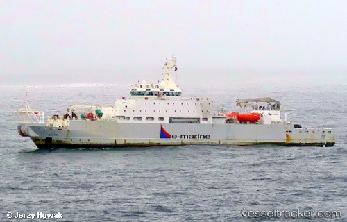
Maram
Current StatusWhere is the vessel?
Maram is currently in Near Ra’S Shukhayr, based on AIS data received about 14h ago.
Latest AIS update:
Current position: 28.12833° N, 33.36833° E (Near Ra’S Shukhayr)
Average speed (last 7 days): Loading…
Average speed (last 30 days): Loading…
Vessel profile: Maram is a Cable Layer with dimensions 17m x 126m.
This page combines live AIS, route history, probable destination signals, nearby traffic, and port activity for practical vessel monitoring.
The current position of vessel Maram is 28.12833 lat / 33.36833 lng. Updated: 2026-05-26 07:47:04 UTCNearest reference points:
- Near Ras Gharib
- 19 nm SE of Zeit Bay
- Near El-Guna (El Gouna)
Details:
Live Vessel Maram Analytics (details, animations, etc.)
Recent AIS points (UTC):
2026-05-26 04:04:45 UTC · 28.12775, 33.36917 · SOG 0.2 kn · COG 135°2026-05-26 05:01:37 UTC · 28.12833, 33.36833 · SOG 0 kn · COG -1°
2026-05-26 07:47:04 UTC · 28.12833, 33.36833 · SOG 0 kn · COG -1°
2026-05-26 07:47:04 UTC · 28.12833, 33.36833 · SOG 0 kn · COG -1°