 vesseltracker.com
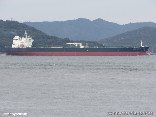
 T.KURUCESME
Current Status
Where is the vessel?
T.KURUCESME is currently in Near Aliaga, based on AIS data received about 1h ago.
Latest AIS update:
Current position: 38.83132° N, 26.95046° E (Near Aliaga)
Average speed (last 7 days): Loading…
Average speed (last 30 days): Loading…
Vessel profile: T.KURUCESME is a Crude Oil Tanker with dimensions 42m x 244m.
This page combines live AIS, route history, probable destination signals, nearby traffic, and port activity for practical vessel monitoring.
The current position of vessel T.KURUCESME is 38.83132 lat / 26.95046 lng. Updated: 2026-05-14 00:13:57 UTCNearest reference points:
- Near Aliaga
- Near Nemrut Bay
- Near NEMRUT
Currently sailing under the flag of Turkey ![]()
T.KURUCESME built in 0 year
Deadweight:
0 tDetails:
Live Vessel T.KURUCESME Analytics (details, animations, etc.)
Recent AIS points (UTC):
2026-05-13 20:13:50 UTC · 38.83134, 26.95047 · SOG 0 kn · COG 356°2026-05-13 21:31:55 UTC · 38.83133, 26.95049 · SOG 0 kn · COG 356°
2026-05-13 22:40:54 UTC · 38.83132, 26.95046 · SOG 0 kn · COG 356°
2026-05-14 00:13:57 UTC · 38.83132, 26.95046 · SOG 0 kn · COG 356°