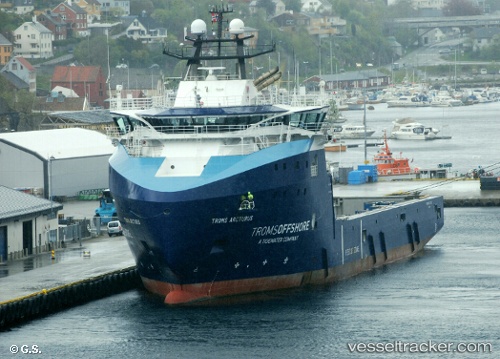
 Troms Arcturus
Current Status
Where is the vessel?
Troms Arcturus is currently in 15 nm NW of Veiholmen, based on AIS data received about 14h ago.
Latest AIS update:
Current position: 63.63314° N, 7.43830° E (15 nm NW of Veiholmen)
Average speed (last 7 days): Loading…
Average speed (last 30 days): Loading…
Vessel profile: Troms Arcturus is a Offshore Tug Supply Ship with dimensions 95m x 95m.
This page combines live AIS, route history, probable destination signals, nearby traffic, and port activity for practical vessel monitoring.
The current position of vessel Troms Arcturus is 63.63314 lat / 7.43830 lng. Updated: 2026-05-21 04:29:54 UTCNearest reference points:
- Near Smøla
- Near Kristiansund
- Near ELNESVAGEN
Currently sailing under the flag of Norway ![]()
Troms Arcturus built in 2014 year
Deadweight:
5580 tDetails:
Live Vessel Troms Arcturus Analytics (details, animations, etc.)
Recent AIS points (UTC):
2026-05-21 01:29:24 UTC · 64.06908, 7.28119 · SOG 9 kn · COG 171°2026-05-21 01:45:54 UTC · 64.02863, 7.29774 · SOG 9 kn · COG 171°
2026-05-21 04:05:04 UTC · 63.69112, 7.42535 · SOG 8.4 kn · COG 172°
2026-05-21 04:29:54 UTC · 63.63314, 7.43830 · SOG 8.2 kn · COG 172°