 Symi I
Current Status
Where is the vessel?
Symi I is currently in 211 nm W of Diego Garcia, based on AIS data received about 15h ago.
Latest AIS update:
Current position: 6.92058° S, 68.94803° E (211 nm W of Diego Garcia)
Average speed (last 7 days): Loading…
Average speed (last 30 days): Loading…
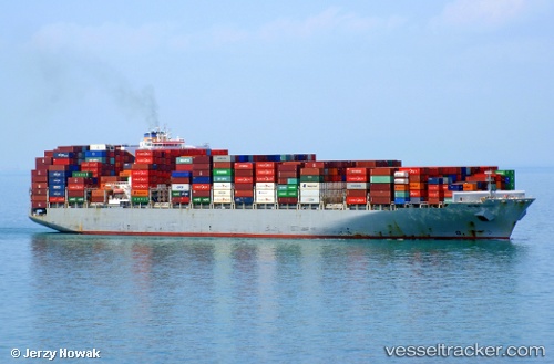
Vessel profile: Symi I is a Container Ship with dimensions 300m x 300m.
This page combines live AIS, route history, probable destination signals, nearby traffic, and port activity for practical vessel monitoring.
The current position of vessel Symi I is -6.92058 lat / 68.94803 lng. Updated: 2026-05-20 23:24:06 UTCNearest reference points:
- 147 nm W of Diego Garcia
Currently sailing under the flag of Liberia ![]()
Symi I built in 2014 year
Deadweight:
111700 tDetails:
Live Vessel Symi I Analytics (details, animations, etc.)
Recent AIS points (UTC):
2026-05-20 18:01:25 UTC · -5.84548, 70.34903 · SOG 19.3 kn · COG 231°2026-05-20 21:41:12 UTC · -6.57796, 69.40002 · SOG 19.6 kn · COG 235°
2026-05-20 22:10:13 UTC · -6.67318, 69.27145 · SOG 19.8 kn · COG 235°
2026-05-20 23:24:06 UTC · -6.92058, 68.94803 · SOG 19.8 kn · COG 233°