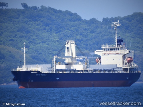
White Tomony
Current StatusWhere is the vessel?
White Tomony is currently in Near Pat Bangkok, based on AIS data received about 14h ago.
Latest AIS update:
Current position: 13.70346° N, 100.57573° E (Near Pat Bangkok)
Average speed (last 7 days): Loading…
Average speed (last 30 days): Loading…
Vessel profile: White Tomony is a General Cargo Ship with dimensions 20m x 128m.
This page combines live AIS, route history, probable destination signals, nearby traffic, and port activity for practical vessel monitoring.
The current position of vessel White Tomony is 13.70346 lat / 100.57573 lng. Updated: 2026-05-22 08:29:32 UTCNearest reference points:
- Near T S Transport and Logistics
- Near Bangkok Modern Terminals/Bangkok
- Near Nim Port
Details:
Live Vessel White Tomony Analytics (details, animations, etc.)
Recent AIS points (UTC):
2026-05-22 04:17:32 UTC · 13.70351, 100.57567 · SOG 0 kn · COG 295°2026-05-22 05:35:32 UTC · 13.70347, 100.57564 · SOG 0 kn · COG 295°
2026-05-22 07:41:32 UTC · 13.70347, 100.57567 · SOG 0 kn · COG 295°
2026-05-22 08:29:32 UTC · 13.70346, 100.57573 · SOG 0 kn · COG 295°