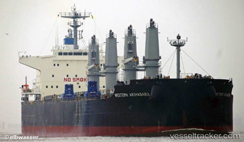
 Blue Akihabara
Current Status
Where is the vessel?
Blue Akihabara is currently in 87 nm E of Belmonte, based on AIS data received about 14h ago.
Latest AIS update:
Current position: 15.96827° S, 37.39982° W (87 nm E of Belmonte)
Average speed (last 7 days): Loading…
Average speed (last 30 days): Loading…
Vessel profile: Blue Akihabara is a Bulk Carrier with dimensions 200m x 32m.
This page combines live AIS, route history, probable destination signals, nearby traffic, and port activity for practical vessel monitoring.
The current position of vessel Blue Akihabara is -15.96827 lat / -37.39982 lng. Updated: 2026-05-21 01:45:34 UTCNearest reference points:
- 169 nm E of Alcobaca
Currently sailing under the flag of Panama ![]()
Details:
Live Vessel Blue Akihabara Analytics (details, animations, etc.)
Recent AIS points (UTC):
2026-05-20 22:17:15 UTC · -15.32400, -37.17057 · SOG 11.8 kn · COG 195°2026-05-20 23:55:27 UTC · -15.62684, -37.27787 · SOG 11.9 kn · COG 195°
2026-05-21 01:32:26 UTC · -15.92736, -37.38647 · SOG 11.6 kn · COG 196°
2026-05-21 01:45:34 UTC · -15.96827, -37.39982 · SOG 11.7 kn · COG 196°