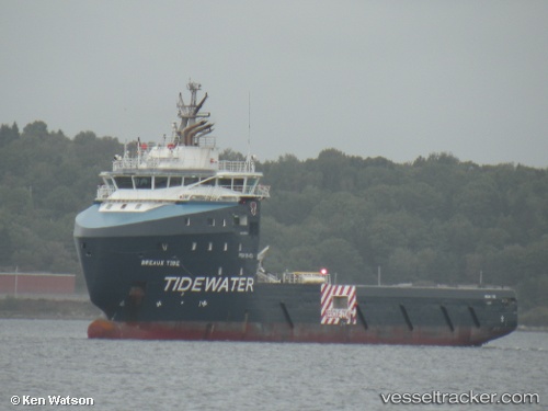
Breaux Tide
Current StatusWhere is the vessel?
Breaux Tide is currently in 93 nm N of Nieuw Amsterdam, based on AIS data received about 16h ago.
Latest AIS update:
Current position: 7.38209° N, 55.48467° W (93 nm N of Nieuw Amsterdam)
Average speed (last 7 days): Loading…
Average speed (last 30 days): Loading…
Vessel profile: Breaux Tide is a Offshore Tug Supply Ship with dimensions 20m x 84m.
This page combines live AIS, route history, probable destination signals, nearby traffic, and port activity for practical vessel monitoring.
The current position of vessel Breaux Tide is 7.38209 lat / -55.48467 lng. Updated: 2026-05-24 19:21:15 UTCNearest reference points:
- 38 nm NW of Jarikaba
- Near Paramaribo Zorg en Hoop Airport
Details:
Live Vessel Breaux Tide Analytics (details, animations, etc.)
Recent AIS points (UTC):
2026-05-24 16:22:37 UTC · 7.38314, -55.48425 · SOG 0.7 kn · COG 109°2026-05-24 18:02:15 UTC · 7.38144, -55.48478 · SOG 1.1 kn · COG 104°
2026-05-24 19:10:56 UTC · 7.38215, -55.48455 · SOG 0.3 kn · COG 103°
2026-05-24 19:21:15 UTC · 7.38209, -55.48467 · SOG 0.4 kn · COG 102°